Historic Markers in the City of Mobile
Water Street Area
There are seventeen historic markers located in the Water Street to Conception Street area. This area is bordered by St. Louis, Conception, Church, and Water streets.
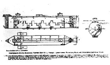
Location: Southeast corner of Church, at Water.
Text: First submarine successfully used in warfare was completed on this site in 1863. Designed by James McClintock and Baxter Watson, and financed by Horace L. Hunley, it was built by W. A. Alexander at the Mobile Machine Shop of Park & Lyons. After trials in Mobile River and Mobile Bay, it was sent by rail to Charleston, where, on February 17, 1864, it sank the USS Housatonic.
Historic Mobile Preservation Society 1957
*This marker cannot be viewed. It is currently stored in the warehouse of the History Museum of Mobile.
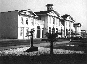
Location: Southeast corner of Government, at Royal.
Text: Erected 1853-1858. Southern Market buildings and municipal offices. Also served as a military armory before and after the Civil War. Stalls for farmers, butchers, game sellers, and fishermen were on the ground floor. Officially registered in 1969 in the National Register of Historic Places. Seat of municipal government since 1858.
Historic Mobile Preservation Society 1970
*This location now houses the History Museum of Mobile. The marker for this location can be found inside the building. In order to view this marker interested parties must purchase a ticket.
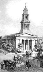
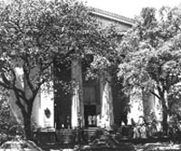
Location: 115 Church Street (Southeast corner of Church, at St. Emanuel).
Historic Mobile Preservation Society 1953
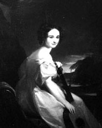
Marker Number 11: Office of Dr. Henry LeVert, 1804-1864.
Location: 153 Government Street, at Royal.
Text: Mobile Physician, 1829-1864. Son of Dr. Claudeus LeVert, who came to Virginia as
fleet surgeon under General Rochambeau. This Italianate style building served as a
doctor's office for one hundred years, 1858-1954. Preserved by the action of the Mobile
County Commission, May 1971.
Historic Mobile Preservation Society 1939 (replaced 1979)
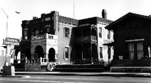
Marker Number 12: The Mobile Bar Association.
Location: Next to Levert Office.
Text: On March 29, 1869, thirty-two attorneys organized the Mobile Bar Association, the
first bar association in Alabama and the fourteenth oldest in the entire nation. They
filed the Association's Declaration of Incorporation on April 12, 1869, having contributed
$5,000 in capital, and established a law library in the city of Mobile.
Dedicated in commemoration of the 130th anniversary
of the founding this 18th day of April 1999
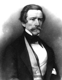
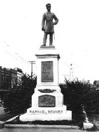
Location: Government Street, just east of Royal.
Text: Admiral Raphael Semmes, C.S.A. Commander of the most successful sea raider in history, CSS Alabama. Still, after these many years, his patriotism and heroic deeds inspire us to cherish our American liberties! Centennial Memorial 1900-2000.
Sons of the Confederate Veterans, Admiral Raphael Semmes Camp 11, June 27, 2000
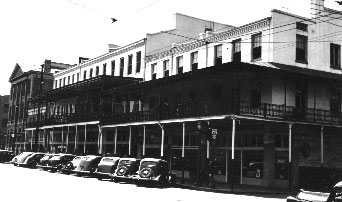
Marker Number 14: La Clede Hotel.
Location: Northeast corner of Government, at St. Emanuel.
Text: Constructed 1855-56-1940. Originally two federal style structures with party walls.
Later enlarged to include a third brick building, unified by the overhanging cast
iron galley. From shops and private living quarters, it evolved into a popular 19th
century hotel and center of social life. The La Clede Hotel continued to function
as a hotel until 1963.
Historic Mobile Preservation Society 1983
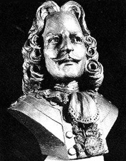
Marker Number 15: Cadillac Homesite.
Location: Conti Street, 1/2 block west of Royal.
Text: Here stood the home of Antoine de la Mothe Cadillac, soldier of fortune under Louis
XIV. Founder of Detroit, 1701; prominent personage in Canada until 1710. He lived
here during his residence in Mobile (1713-1717) as Royal Governor of Louisiana.
Historic Mobile Preservation Society 1953
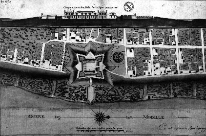
Location #1: Royal Street, between Conti and St. Francis.
Text: When Mobile was laid out, this was the city's northeast boundary point. Royal Street ran along a bluff overlooking the Mobile River. There were no streets between Royal and the river, only marshland.
Marker Number 23:
Location #2: Conception Street, between St. Francis and St. Louis.
Text: At this point the northwest limits of French Mobile faded into the dense forest which surrounded the city in 1711 and for many years thereafter. An 1815 map shows the forest reaching Joachim Street, one block west.
Marker Number 29:
Location #3: Southeast corner of Government, at Jackson.
Text: This site marks the southwestern limit of the city of Mobile in 1711. Known then as Fort Louis de la Mobile, it had been founded by the French at 27-Mile Bluff in 1702 and moved to its present site in 1711. Mobile has been a city under six flags. The French flag was followed by the English, Spanish, American, Republic of Alabama, and again American. This is an unusual record.
Christopher Branch Chapter, Colonial Dames XVII Center (not dated)
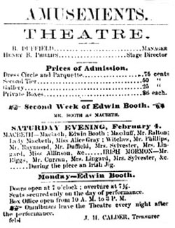
Marker Number 17: Site of Sixth Mobile Theater, 1841-1860.
Location: Northwest corner of Royal, at St. Michael.
Text: Here played the great of the American and British stage, among them: James Wallack,
Fanny Kemble, Old Bull, Joseph Field, Joseph Jefferson, James H. Hackett, William
Macready, Charlotte Cushman, Edwin Forrest, Julia Dean, Junius Booth, Anna Mowatt,
Charles Kean, Ellen Tree, Edwin Booth, and Lola Montez. Henry Clay and President Fillmore
attended performances here as the guest of Madame LeVert.
Historic Mobile Preservation Society 1940 (replaced 1953)
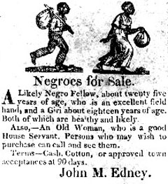
Marker Number 18: Slave Markets.
Location: Northwest corner of Royal, at St. Louis.
Text: On this site stood one of the old slave markets. Last cargo of slaves arrived on
the schooner Clotilde in August of 1859.
Historic Mobile Preservation Society 1940 (replaced 1959)
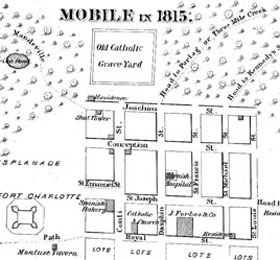
Location: 56 St. Francis Street (Northeast corner of St. Francis, at St. Joseph).
Text: Here stood in Spanish times the great Indian trading house John Forbes & Company.
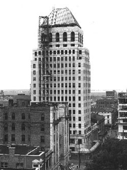
Marker Number 20: Merchants National Bank Building.
Location: 56 St. Francis Street (Northeast corner of St. Francis, at St. Joseph).
Text: The incorporation of the Merchants National Bank of Mobile was authorized April 13,
1901 with offices at 56 St. Francis Street. On July 1, 1927, Merchants became a national
bank and occupied this eighteen-story building which was dedicated October 11, 1929.
Merchants National merged with First Alabama Bancshares, Inc. on October 29, 1983.
The name Merchants National Bank of Mobile was changed to First Alabama Bank on July
1, 1985.
(not inscribed)
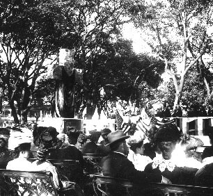
Marker Number 21: St. Andrew's Cross.
Location: Dauphin Street, between Conception and St. Joseph (Bienville Square).
Text: To Jean Baptiste Le Moyne, Sieur de Bienville. Native of Montreal, Canada, Naval
Officer of France, Governor of Louisiana, and founder of the first capital, Mobile,
in 1711. Born: 1680; Died: 1768. With the genius to create an empire and the courage
to maintain it, patient amid faction and successful even in defeat, he brought his
settlement the prosperity of true civilization and the happiness of real Christianity.
He who founds a city builds himself a life-long monument.
Colonial Dames of Alabama February 1906
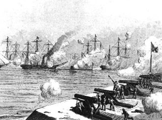
Marker Number 22: Battle of Mobile Bay.
Location: Northwest corner of St. Joseph, at Dauphin.
Text: In memory of the Battle of Mobile Bay, one of the fiercest and most decisive battles
in naval history.
Commemorated on the Centennial, August 5, 1964.
City of Mobile; Joseph P. Langan, Mayor of Mobile; Leroy Stevens, Mobile County Commission;
Martin J. Johnson, Chairman of Centennial Commission 1964
Location: Southeast corner of St. Francis Street, at Conception.
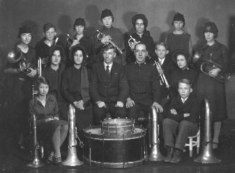
Text: At the corner of Conception and St. Francis streets, Captain Edward Justus Parker, Staff-Captain Charles Miles, and a Salvation Army lieutenant conducted an open air meeting on the night of their arrival in March 1887. In contrast to other Salvation Army openings in other cities, the Mobile audience was polite. Men removed their hats as prayer was offered and those in attendance respectfully participated in the singing and dropped coins into the collection plate. Mobile became an official Salvation Army Corps on October 13, 1899, with Captain and Mrs. James T. Cumbie in command. The Army's first Corps Community Center in Mobile was located at 213 Conti Street where it remained from the late 1930s until the late 1960s. The Salvation Army's fight against human suffering, started in 1865 in London by General William Booth, is still helping people to help themselves, though its methods have changed with the times.


